WEATHER CALCULATOR
Meteorologist uses Atari as home forcasting tool
Article by GIGI BISSON, Program by E. JAN NULL
Make weather predictions with the same program a professional meteorologist uses to calculateweather readings at home on his Atari 800. With Weather Calculator and your outdoor thermometer, you can convert Celsius temperature readings to Fahrenheit, find the relative humidity, estimated cloud base, wind chill factor and predict sunrise and sunset times for any given date. The BASIC program works on all 8- bit Atari computers of any memory size, with disk or cassette.
Jan Null is the weatherman behind the weathermen. Before the daily forecast reaches the television evening news, Null, along with a team of meteorologists writes the warnings and forecasts that all of Northern and Central California depend on.
As a lead forecaster at the National Weather Service office in Redwood City, California, Null coordinates the satellite photos and weather band radio broadcasts used by pilots and ships at sea. In times of disaster, he works with state and local agencies, the Coast Guard and National Guard to prepare for major storms, floods, tornados and tsunamis.
Six years ago he found a new forecasting tool to add to the National Weather Service's cache of sophisticated instruments, satellite dish antennas, and mainframe computers-- an Atari 800 computer. At home with his Atari, a modem and a terminal emulation program, Null logs onto the weather service's huge Data General computers. He can keep up on the latest weather changes--and find out if the predictions he made earlier at work are accurate. He also does weather research on the CompuServe information Service. (Just type GO WEA at any ! prompt to use that weather database.)
Null also uses his Atari to make computer printouts of the temperature conversion tables that he uses for calculating weather conditions. Eventually, those tables grew into Weather Calc--a very simple, menu-driven program.
USING THE PROGRAM
To use this program, type in Listing 1, WX.BAS, check it with TYPO II and SAVE a copy before you RUN it.
TEMPERATURE CONVERSTION
Weather Calc's temperature converter translates Celsius temperature readings into Fahrenheit or Kelvin measurements and back again. Simply type in the temperature reading. The program does the calculations.
DEW POINT
HUMIDITY
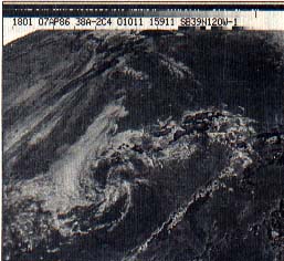
No satellite photos required. All you need to predict weather is Weather Calc and a thermometer.
ESTIMATED CLOUD BASE
The dew point is the temperature to which the air must be cooled in order to convert water vapor into liquid. For example, when beads of water form on the outside of an ice-filled glass, or water vaper turns into rain. To determine this, type in the dry bulb temperature (a reading taken with a regular thermometer) and then enter the wet bulb temperature (a reading taken with a sling psychrometer).
If you don't have a sling psychrometer, Null suggests simply wrapping a small piece of wet gauze around the bulb of the same thermometer used for the dry bulb reading. Carefully swish the thermometer back and forth in the air a few times to get the air circulating through the gauze. This reading should be lower--reflecting the cooling effect of the evaporation caused by the wet cloth. Using the two readings, the program calculates the dew point, humidity, and estimated cloud base.
What is the cloud base? A certain temperature and dew point exist on ground surface under normal conditions. As you go higher in the atmosphere, the air temperature cools faster than the dew point temperature. Condensation and clouds form when both readings reach the same point. So the closer the temperature and dew point readings are, the lower the cloud cover will be-if they're within five degrees, expect fog.
WIND CHILL FACTOR
The temperature may be 50 degrees, but if the wind is blowing at 20 miles per hour, the chilling effect on exposed skin will feel like 30 degrees--much colder than the air temperature suggests. That's the wind chill factor at work. To calculate this, enter the air temperature and wind speed. (To find the wind speed, call your nearest National Weather Service office, or tune into the weather band on a shortwave radio with police band or, use the weather maps from your WEFAX programs..)
SUNRISE/SUNSET
Find out what time the sun will rise and set on any day in any year. Enter the latitude and longitude in degrees and minutes (for example: Latitude: 35, 27; Longitude: 135, 5) and then the date. ForJuly 28, 1987, you'd enter 07,28,1987.
The program will calculate an estimated time of sunrise and sunset, accurate within a minute or two. Add one hour if the date is during daylight savings time. The actual time the sun rises or sets in a particular location may also depend on the surrounding terrain--mountains, hills and such. To find the latitude and longitude, consult a map or almanac, check the public library, ask a science teacher or call the nearest National Weather Service office.
The basic formulas for the meteorological calculations in this program are from the Smithsonian Meteorological Tables. Those for the sunrise and sunset data are from Almanac for Computers, US Naval Observatory.
Listing:WX.BAS Download